



[ad_1]
Mapping data from NASA shows the extent of wildfires raging across the Northwest Territories and British Columbia where several towns have been damaged, forcing thousands of residents to flee their homes.
The Fire Information for Resource Management System U.S./Canada (FIRMS) created by NASA and the USDA Forest Service shows real-time updates of where wildfires are in Canada and the U.S. and how intensely they’re burning.
Satellite imagery shows most of the West and Northwest central regions of Canada in a sea of orange flames icons, locating the active wildfires outside Yellowknife, N.W.T. and Okanagan, B.C.
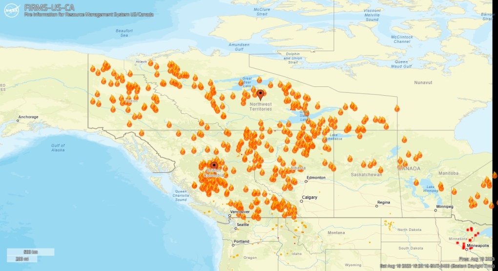 Mapping data from NASA shows the extent of wildfires raging across Canada as the Northwest Territories and British Columbia remain under a state of emergency. (FIRMS US/CANADA)As of Saturday afternoon, there are 236 active fires in the Northwest Territories and 380 in British Columbia.
According to the map, both sides of Okanagan Lake continue to battle with fires—red-colour coded icons represent “thermal anomalies” in the region. The data also shows how long a hotspot has been active and according to the map, orange to light-yellow icons show most of the fires in that region have been ongoing for more than 6-24 hours from detection.
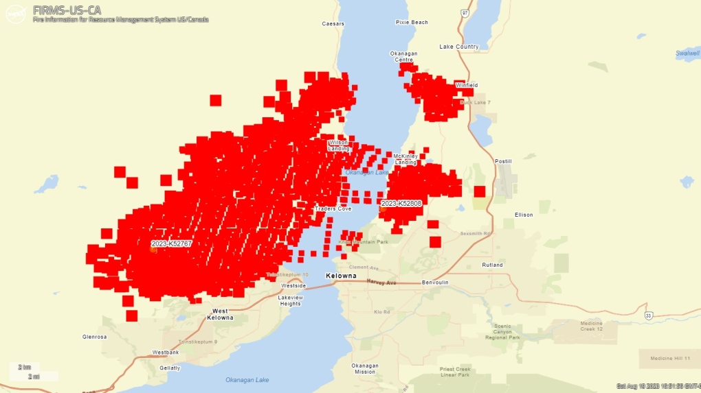 Mapping data from NASA shows the extent of wildfires raging across British Columbia. (FIRMS US/CANADA)Much of the fires in northern Canada are between Fort Smith and Hay River, N.W.T. and northern Alberta, where there are three out of control fires, according to the Alberta Wildfire status dashboard.
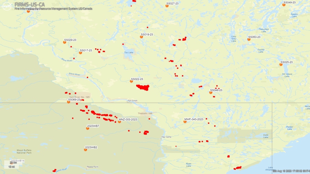 Mapping data from NASA shows the extent of wildfires raging across the Northwest Territories. (FIRMS US/CANADA)Canada has seen an unprecedented wildfire season as thousands of kilometres of land have been burned, forcing thousands of residents to flee their homes and cross into neighbouring towns, provinces and territories.
With files from Micheal Lee.
[ad_2]
Source link
